Finale

August 29th. Well, the long ride to Bridgewater helped dodge a storm. Tropical storm Erin was supposed to bring heavy rain to all of Nova Scotia, but it only brought it to the northwest shore. Bridgewater was overcast, but with only occasional rain. Having anticipated a day of torrential rain, I planned to take cover. So, without the rain, it became a day of exploring and taking care of little things. Even chatted for a while with a small group that included a couple of motorcyclists from New Zealand who were touring the Maritimes.

The next day was the trip to Halifax. End game!

The southeast shore of Nova Scotia is heavily touristed, so the trail was well maintained. After starting out using roads so as to enjoy the scenery of shoreline towns, I switched to the trail for a more tranquil ride. There were a lot of cyclists on the trail. But it was not as hilly as I expected, so the 120km to Halifax seemed leisurely – it’s amusing that I can say that.

The snake in the picture is only about 7 inches long.

20190830_125846

Peggy’s Cove and Halifax are particularly worth the visit. Halifax’s immigration museum (Pier 21) preserves the arrival point for over a million immigrants who came to Canada between 1938 and 1971 – I arrived in 1963. Peggy’s Cove is beautiful by day (when the ocean is calm), and spectacular in the evening during sunset. And some of the best seafood in NS can be had along the road to Peggy’s Cove from Halifax.

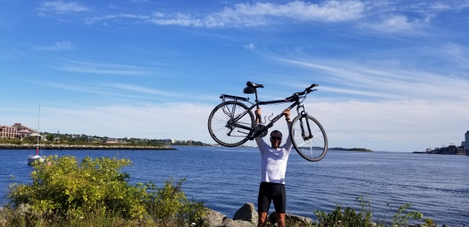
So, the arrival in Halifax (August 30th) marked the end of the journey that started in Vancouver. Altogether, the ride was more than 6,700km over 57 (non-consecutive 🙂 ) days. During that time, the ascents added up to almost 26km. Going across Canada at that pace has its rewards – you see things up close in ways you would miss by driving the same route. It is a trip well worth taking for anyone who enjoys cycling – the stamina part of it is not that important since anyone can do it at their own pace. My only regret is that I wasn’t able to detour more often and take in more of the Canadian experience…but there is always another time!

20190901_163206

The Maritimes don’t do flat ^^^^^

August 27th. The southward trek continued on country roads. There is a long-developed network of roads in New Brunswick and Nova Scotia that connects farms and logging areas. Those roads are sparsely populated, and great for bicycling. The network is even more extensive than Ontario’s in the area between Orillia and Ottawa – perhaps because part of that area in Ontario is rocky (the Canadian Shield), which makes farming difficult.

The road network is particularly great since, as one person put it, people in these parts are nuts about their atv’s – actually, I think all rural areas with 14 to 16-year old guys (read testosterone laden) are nuts about atv’s, but some jurisdictions are more successful in keeping them off the bicycle trails.

On the way to Saint John I caught sight of a particularly amusing lawn sign …


20190827_183127

Since Monday (the 26th), the long-term weather forecast for the Maritimes had been gloomy. A tropical depression in the US was going to come north. The risk was that would force a pause to sit out the storm … and lose a day. But Halifax for Friday evening (the 30th) was still the objective. So what had been planned as a 3 day journey had to be covered in 2 days. After getting up early and getting to the ferry in time (8 am), there would be another 135km ride to get to Bridgewater. Bridgewater was close enough to Halifax to make arriving Friday possible even without travelling on Thursday.

But the Maritimes don’t do flat! There are endless hills that are barely noticeable in cars, but that make for an “interesting” day on a bicycle. Since entering New Brunswick, the average daily ascent has been 1000metres. On this particularly long day to Bridgewater, the total ascent was almost 1300 meters. That was the kind of daily ascent done in the mountains in British Columbia.

Even so, the occasional towns and places of interest are so rewarding. I stopped in Bear River and came across a community of artists whose work is highly regarded. I want to come back and buy a stained-glass piece. And there are fruitstands where blueberries and strawberries are nice little rewards for the endless hills.

And there are organised cycle groups with an escort vehicle — the Maritimes are popular.

And people here are welcoming to everyone. Indeed, they let Trump build his wall here… (zoom in to the centre of the picture)

20190828_113436

So I sat out the storm in Bridgewater, and will go to Halifax on Friday.

On to Fredericton

It rained! During the stay at Pointe St Michel there were periods without rain, making it possible to venture out and explore. But mostly it rained. There were flashes of lightning that were followed immediately by thunder. In the middle of the night it happened again and there was a lot of floor creaking as people awaken by the thunder were walking about.

But by the next morning most of the clouds were gone. All that remained of the storm was a strong wind … blowing east! A sail would have let me fly on the bike. The 160+ kilometers to Riviere du Loup went by quickly and even left enough time to do some sightseeing. That, in spite of a first flat tire – luck had to run out at some point.

20190822_192515

The travel along this part of Quebec is picturesque and the small towns with churches evoke a long history and traditions.

20190822_163943

After over-nighting in St Anonin, the direction to Halifax changed and would now be primarily southbound. There is a well-known bicycle trail (old railroad track) called Petit Temis that runs all the way to New Brunswick (welcome to NB sign in photo).

20190823_185723

The cycle was along good nature trails, with climbs that are always gentle (unlike the Rockies!).

20190824_162224

While setting up camp for the night in a provincial park, a group walked by and one person noticed the bike and came over to talk. Turns out he is a triathlete. I’m not sure, but I think he might have invited me over to their campsite for later on (they have a motorhome). I was really struggling to understand him with his strong Acadian accent – it was the first time that I had heard it. And yes, you do see the Acadian flags a lot in these parts.

The bike paths continue in NB, but become progressively rougher. It seems there is little stopping the ATVs from using them.

So more and more I went on the roads when I could find a side-roads with little traffic. Country side-roads are always pleasant with occasional houses and small towns – it’s the attraction that gets one on a bike for a long-distance ride.

Perth-Andover is very much in the English-speaking part of NB. The accent seems much less pronounced than the Acadian accent – I was expecting a stronger maritime accent.

The cycle to Nackawic, and then Fredericton, was mostly on roads along the St John river. The wood-covered bridge at Hartland was impressive.

Being on the road had the added advantage of making it possible to find great little restaurants that served breakfast big enough to last until dinner.

A bit of trivia…on the cycle to Nackawic the odometer tripped 1000km. 500+ to go!

The history of Fredericton goes back a long way. It was long a garrison town that was built on a flood plain. There is now an art piece by the river that commemorates the floods by showing their various water levels. It was added to in 2018 after a major flood that surpassed most of the other recorded floods. But the city is still here, and vibrant with trendy streets in the downtown area.

20190826_172159

Around Quebec City

Victoriaville should ring a bell for any one who has played hockey…they make the famous hockey sticks. I remember them from my (short and without distinction) hockey career.

The bicycle trail runs right through the heart of the city (as an old railway line should!), and it seems that in the evening half the town is either cycling or walking the trail (I walked).

The next day, cycling to Quebec City, there were a lot more people on the trail than there had been approaching Victoriaville. What was really quaint was the number of couples in their 50s, 60s, and even 70s. Cycling together seems to be a popular pastime for older couples in this area. One guy (in his 70s I think) rode alongside me for a while and we chatted about our respective bike trips. He has cycled through many European countries and intends to add to his list. I think he would have passed me even if I didn’t have a fully loaded bike.

A last-mile glitch prolonged the cycle into Levis. The bridge at Parc des Chutes de la Chaudiere has been out for repairs for the past month. A 10km detour just within sight of the destination.

Most people I know have visited Quebec City and think it’s a real gem. A city that is as modern as any other in Canada, but with a charm and history like no other. This trip made me realise that I really should come back and spend time on the island (Ile d’Orleans)…one more for the bucket list. Even better would be on a motorcycle.

20190821_112012

The next day started off badly, and kept getting worse until a silver lining appeared. It was raining when I started, but decided to go out anyways. It stopped shortly afterwards. Later on, it started and stopped again. Each time, I could see some clear skies to the west, so I didn’t think the rain would last. The third time, however, the rain was clearly something that would continue for a long time. So I pulled over and grabbed a bite to eat. The person behind the counter recommended a B&B in town. It turned out to be perfect. Did a laundry and relaxed in a charming old house along the St Laurent.

20190821_144753

2018 was a good year, but …

There was some unfinished business from 2018!

Well, at the last minute the waters parted in August and I was able to leave again. The office can do without me for a while, so time to finish the course started last year – ocean to ocean.

Saturday morning (August 17th) headed east on the Prescott-Russell trail. An old railway bed that is now maintained (it seems to be) for general use. They keep ATVs off it … yay! Cycled for a few km with a young guy around 16 years old going to visit his girlfriend. He said an objective of his was to cycle across Canada. He is going to try to do it next summer.img_1946.jpg

The trail ends close to Rigaud, and then there is a nice cycle through Hudson (an upscale suburb of Montreal). Even more impressive (upscale) was the river’s edge along Baie-d’Urfie. Nice homes.

Stayed at Kimberly’s Airbnb. Kimberly is an artist. Amusing that I arrive while she and her partner were hosting an event for friends. Joined them for a while and had the pleasant experience of going to a cocktail party in an upscale part of Montreal after cycling 145km.

img_1968.jpg

Amusing also that her dog Sass got into some pizzelle that I had. Cute dog, though, so I couldn’t hold it against her.

Next day (August 18th) was the ride past Montreal. Amazing how the city accommodates (encourages) cycling. Went through the heart of the city almost always on paved bicycle trails. No rain, even though I heard it rain both days in Ottawa.

The trail went through Ganby, and then Yamaska Park. Lots of people enjoying a day of picnicking at the beach. By the time I reached the stop near St-Joachim de Shefford, I was beat. But it was worth it. 290 km in two days was planned so I could then cruise the rest of the way to Halifax. 100km per day from now on.

August 19th. Well, now I have a better appreciation of the bike culture in Quebec. It seems most old railway beds are being maintained for recreational use, particularly cycling. So much more civilised than other parts I travelled through last year. Indeed, the photo of the tourism centre (with a bike shop) is on a bike trail…albeit on Route Verte #1. That’s one of the main bike routes across Quebec.

20190819_155159

This province really accommodates people who are traveling by bicycle.

I was surprised to see the scale of the farms in Quebec. The fields were large. They support industrial-scale agriculture rather than the typical family-farm scale. I didn’t expect that given the common perception that agriculture is protected in Quebec.

The countryside in Quebec has much in common with Ontario. You can feel that the towns have been here for a couple of hundred years, and they are surprisingly prosperous.

Epilogue

In raw statistics, the trip was quite a journey. When I reached home, the odometer on the gps read 5,177 kilometers. This included some evening cycling to get groceries, etc, as well as some wrong turns. I twice added about 10km when I had to go back to retrieve something that had fallen off the bike (one time was for a cell phone on the rough trails!) The duration was 41 days. Over that distance the gps indicated some 17,165 meters of climbing, with the highest point being 1532 meters (Blueberry-Paulson Summit approaching Castlegar). Vancouver is at sea level.

The drivetrain on the bike is now pretty worn. At about Peterborough I noticed that when I put a lot of pressure on the pedals, the chain would slip. I will have it looked at professionally, but this isn’t surprising given the distance travelled with that much climbing and weight. By drivetrain I mean the chainrings, chain, and cogs.  It will be an open question whether it is more economical to replace the components of the drivetrain myself, or buy a new bike (we’ll see).

Finally, before going on this journey an acquaintance suggested that I do the trip right to the Atlantic coast. If you look at the map of the journey, it seems a short distance further. I said I didn’t have enough holiday time from work to do it. So he said that I should just pause in Ottawa for a year and then finish it next summer. I immediately latched onto that idea – I’ve been wanting to visit Halifax to check out the immigration museum. Halifax was the main landing point for newcomers to Canada (it’s where I landed in 1963).

To be continued…

The Arrival

The trip from Perth began with a very slow packing up. Nothing was properly folded and packed since it wouldn’t be necessary any more. A couple of other cyclists were in the campsite next to mine and we chatted for a while before I left. The park where I camped happens to be the major mid-route stop for the RLCT cycle tour put on by the Ottawa cycle club. And a year earlier I had cycled to Perth to meet friends at the city’s July music festival. So the route home was well known to me (though the route I use on my own is different from RLCT’s). Perth is a bit of a trendy weekend getaway for people from Ottawa (not that I admit to being trendy!)

I was surprised at just how quickly the ride home happened. Carleton Place seemed to come up almost immediately, and then Stittsville, and finally Kanata where the unpaved trail that had began in Carleton Place ended. A couple of cyclists who were stopped at a traffic light with me asked where I was going when they noticed the gear I was carrying. I said Ottawa. They smiled and then asked where I was coming from. I said Vancouver. They had a look of discovery. They had come across someone who was in the last few kilometers of a cross-country trip. One of them took out his cell phone and made a video of the moment.

A little while later, I caught a glimpse of the Gatineau hills. About as clear a landmark as you can get for someone from the region. A sense then began to come to me that the trip was already part of history. I was re-entering an environment that was very familiar, so the feeling of being away from home was dissipating. I was glad to reaching my destination, but already missing the adventure that went with the travel.

20180819_151129
The Gatineau hills

I continued past the neighbourhood where I live and went to Victoria Island, where I met Chiara for the arrival photo with the Parliament buildings in the background.

20180819_164138

Southern Ontario

After leaving the Bruce Peninsula, with all its scenery and quaint places, I was now travelling more firmly east. This area has a lot of old railway tracks — from its resource and manufacturing days — that have been converted to trails. So, after Meaford there is a trail that lasts for 50km going eastward. And after Lindsay there is a trail that goes all the way through Peterborough and Tweed to Glen Tay.


Those trails are quite picturesque. But for the unwary, it can be quite uncomfortable. I stopped at one point for a brief moment, and after getting off the bike, I noticed that I was parked right beside a patch of poison ivy.

20180818_115033The only drawback of those trails is that, particularly around Sharbot Lake, young guys with ATVs are damaging the trail. This is unfortunate since the trail there is designated as part of the Trans-Canada Trail (or The Great Trail as it is now known). In significant sections, it’s possible to use country roads with very little traffic in place of the trail: e.g. between Campbellford and Tweed.

20180817_141041
Rolling countryside between Peterborough and Tweed

The benefit of that little switch was that I came across the Church-key micro-brewery. So I dropped in, and even bought a bottle to enjoy that evening. The deposit I had to put on the bottle means that I’ll be returning…and it’s worth it.

The ability to do the equivalent of a hike through the woods by using those trails is quite attractive when the alternative is Hwy 7, so one response to the damage done by ATVs might be to change to fatter tires for that part of the trip. Another alternative is to make the voyage longer by using only country roads (on the scale of 60km longer). But for someone who sees his destination as just a couple of days away, prolonging the trip that way was not particularly attractive.

Heading into Tweed, my luck again ran out with the weather. This time it was a thunderstorm. I was more prepared this time, and nothing in the panniers was affected. Three rain-days during a cross-country trip still leaves me feeling pretty lucky in that regard.

In Tweed, since the rain was not forecast to stop until mid-night, I looked for alternatives to camping, and found a bed-and-breakfast…an older house with a very comfortable living room where I spent the evening working on updating the blog – ergo the flurry of blog entries one evening.

How I learned to love my rear-view mirror

Before starting this trip I used Google Streetview to look at roads that I planned to take. I was going to stay on those that had wide shoulders, so I didn’t think I needed a rear-view mirror.

There is a saying that goes something along the lines of (paraphrasing): even the most thought-out battle plans never survive the first contact with the enemy. Well, my pre-planned route survived until I reached Hope, BC, and then got thrown out. But the wide shoulders on the roads in BC, Alberta and Saskatchewan meant that I didn’t need a mirror. About half way through North Dakota, that began to change. On less used roads, occasionally the shoulder would narrow significantly. It seemed to depend on the county, and when the road had last been refinished. The highway that I had originally planned to take (Hwy 2) just seemed too busy to stay on for extended periods (but it had wide shoulders).

So in Walker (an upscale little town on Hwy 200), I bought a mirror that attaches to my helmet. I returned to being a happy camper.

20180821_082939
Mirror attached to helmet. The bandanna was a gift from a shop-owner in Shaunavon who had used it for a July 1 display.

In Ottawa, I had bought a Bontrager flashing rear light. These are very bright (and expensive) lights that cars will see from hundreds of meters away. They auto-adjust for ambient light, so even on a bright sunny day they are highly visible. That was reassuring since the biggest risk on the road is the distracted driver. With that kind of light, so long as the driver looks up within a half kilometer of you, they know you are there (flashing red lights have a habit of getting people’s attention).

Until North Dakota, I thought that was all I needed. After installing the mirror, I realised just how much better off I was. Knowing where cars are around you and what they are doing puts safety back in your own hands. If there was a truck coming from behind and oncoming traffic in the other lane, I could just move unto the unpaved shoulder until the truck passed, and then come back.

One thing I also discovered was that to some extent, I could control traffic around me. If you stay close to the right edge of the lane, then cars coming from behind will not always cross the yellow line to give you space. Some drivers think that giving you about a meter of space is sufficient. I disagreed. So when a car was coming from behind me, and there was no oncoming traffic, I would stay on the right side of the lane, but not hug the edge of it. Then cars would cross the yellow line to pass. In cases where I thought they were not going far enough to the left, I could veer to the right myself to ensure there was a comfortable gap (I had created that margin by not being on the right edge of the lane).

This strategy works well on roads that are not at all busy, and even moderately busy roads. It doesn’t work on busier roads where cars and trucks are too frequent, so I stayed off busy roads without wide shoulders.

Back in Canada

Back in Canada! Feels good to be back. The trip across the bridge at Sault Ste Marie was not as easy as I expected. It turns out they don’t allow bicycles on that bridge. So I had to get a ride.

Cycling the Ontario country-side (avoiding the Trans-Canada) after Sault Ste Marie takes you by lots of lakes and farmland. There seems to be more farming on the Canadian side than there was in UP (Upper Peninsula — that’s how people in Michigan refer to the northern part of the state).

It seems that Sault Ste Marie is a cross-roads for cross-country cyclists. Whether going north or south of Lake Superior, you have to pass through the city. People in places where I stopped were curious about where I was from and how far I had cycled, but they see cyclists from time to time so they are not at all phased by someone going across the country.

Great start to the next day. Had the Trucker’s Breakfast at Anette’s Place (a little restaurant not far from Blind River), and since cyclists burn more calories than truckers, I order 2 pancakes to go with it. That was a challenge to truckers I shouldn’t have ventured. The Trucker’s Breakfast is humongous, and the pancakes were twice the normal size. I wasn’t hungry again all day until dinner (only had watermelon in the afternoon).

The Ontario government is making some effort to build a shoulder for cyclists on the Trans-Canada. They seem to be recognising that more people want to cycle across the country. It’s patchy at this stage, but promising for the future.

So at Espanola I turned south to head toward Manitoulin Island. This promises roads that are not as heavily used by trucks, and have a little more shoulder for cyclists.

The landscape in this area is very scenic (and hilly!)

The ferry to Tobemory is fun. There is nice scenery as the islands go by and a cool breeze off the water. Tobemory seems to be a big tourist destination as well as a transition point.

The next day, I had the “interesting” experience of being awaken in the night by howling coyotes. At the time, I couldn’t tell if they were wolves or coyotes but i looked it up later. So when at 6am some cows from a nearby farm started mooing loudly, I thought maybe wolves had gotten one of their calves. I was wrong on both counts…the cows were just noisy.

South from Tobemory you really get the impression that this area is heavily tourist-ed by Torontonians, and maybe some others. The road is busy, and this was on a Monday. I was told that on weekends during the summer that part of Hwy 6 is not a fun place for cyclists. Unfortunately, cycling down Hwy 6 is like going down a funnel. The shoulder starts nice and wide at Tobemory, but by the time you reach Wiarton, it has pretty much disappeared.

There are lots of side-roads in this part of Ontario and most of them are lightly used. They go through farming communities as well as resort areas on the beach. Particularly striking is that occasionally you go through what seems to be a wealthy suburb of Toronto. The houses are large and well built. They are not on the waterfront, so it would be hard to say that they are “cottages”. Toronto seems to be a dominant economic force felt throughout southern Ontario. It is swallowing whole that part of the province. Even as far as Lindsay you can see large-scale housing developments that I guessed were to accommodate people who intended to commute to work.

Since Ontario used to be an important manufacturing hub, it seems to have transitioned from the industrial era pretty well, with Toronto leading the way. The rise of a (potentially) populist leader makes one nervous that the engine that has been powering Ontario’s growth (Toronto) may get reined in.